
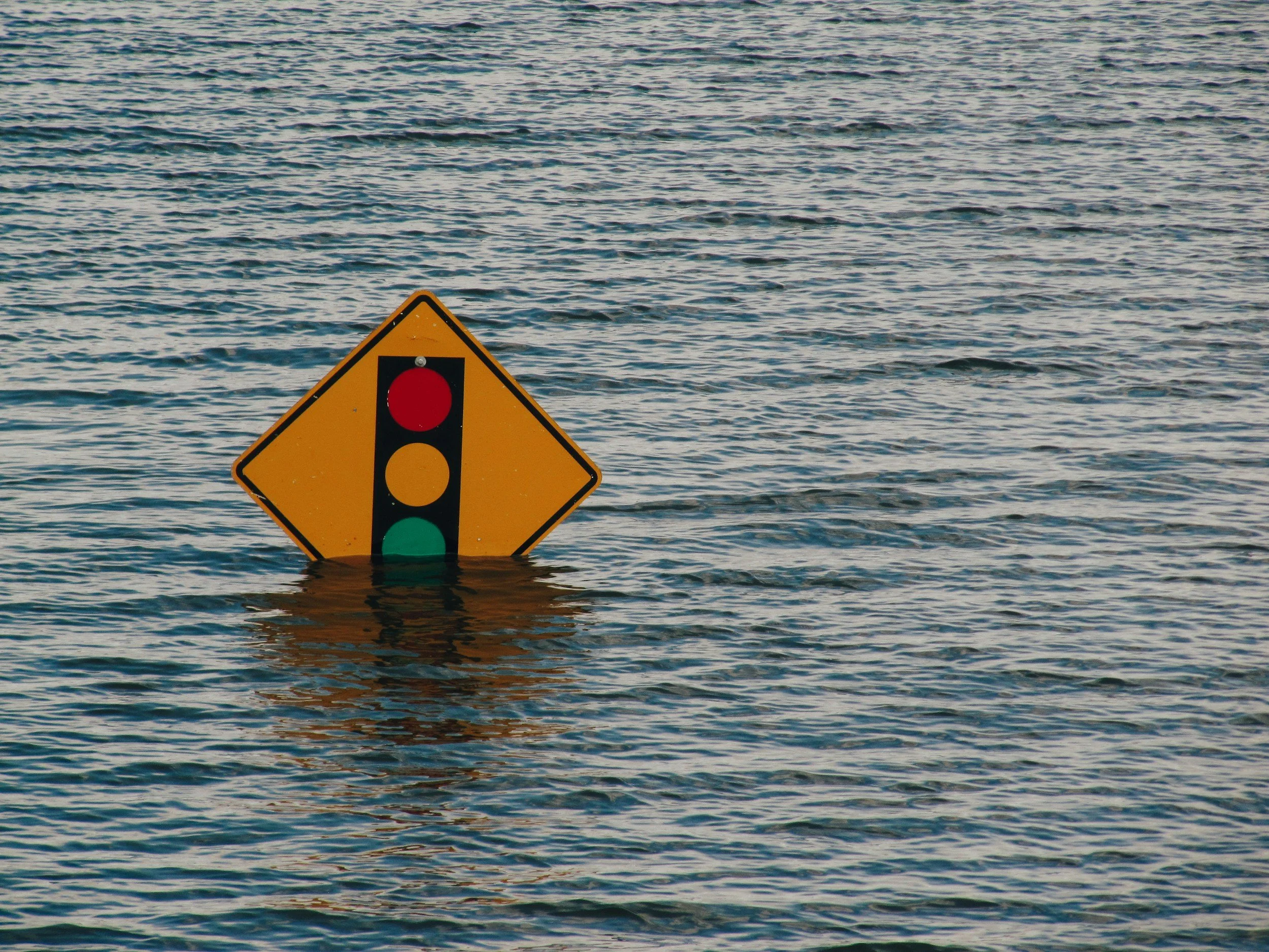
El Niño is a normal weather pattern of periodic warming of sea surface temperatures in the Pacific Ocean that—depending on where one lives—results in events like flooding, drought, or heavy rainfall. With climate change, however, El Niño temperature increases are affecting a sea surface that’s already warmer than average, and this makes the effects even stronger. Climate change also increases the frequency of El Niño occurrence.
Pacific Ocean Temperature Patterns
Normally, this is what happens in the Pacific:
Trade winds push the warm surface water from east to west.
In the east, this leaves a void that cold water from ocean depths rises to fill.
As the cold water rises, it brings nutrients up toward the surface.
In the western Pacific, it creates a reservoir of warmer water.
The warmer water warms the air above it.
Hot air rises into the atmosphere, taking moisture with it, producing rain.
Rising air drives trade winds, starting the cycle again.
Periodically, somewhere between every two and seven years, in what we call an El Niño year, winds weaken:
Warm water moves to the east, bringing rain.
When the water reaches land, the boundary in the ocean between warm surface water and cold water from the depths starts to drop.
This causes a decline in the amount of cold water that rises to the surface.
That means fewer nutrients rise to the surface.
Supersize It
A Super El Niño is simply a more intense El Niño, involving at least a 3.6°F increase over average sea surface temperatures. That greater increase in temperature leads to more powerful effects, such as more intense flooding and storms, worse drought, and even heavier rainfall.
This year’s Super El Niño is predicted to coincide with an increase of 6.12°F over average sea surface temperatures. We haven’t had a Super El Niño like the one predicted for this fall since 1950.
Varying Effects and How to Prepare
The effects of a Super El Niño vary, depending on where you live. For example, the southwestern United States are expected to be wetter and the middle South and Southeast are likely to be cooler than normal until at least April of 2027. The Northeast will likely be drier than normal and the northern states will be warmer.
Since this El Ninõ is expected to be more powerful than usual, because of climate change, it’s hard to say exactly what to prepare for. Nevertheless, there are some basic, general precautions to take.
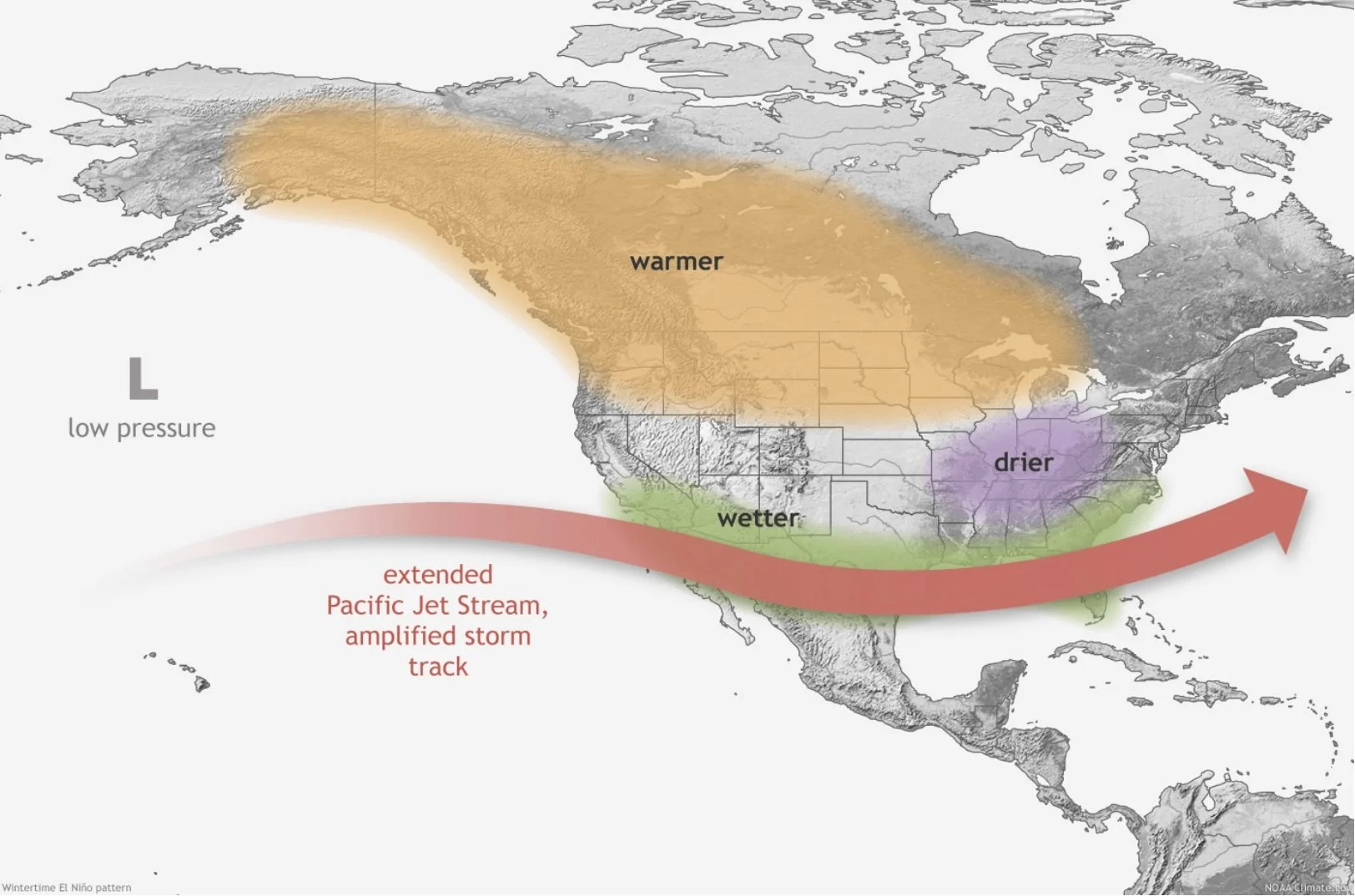
A map of the U.S., Canada, and Central and part of South America showing the effects of El Nino during winter in the Northern Hemisphere. (Image credit: NOAA)
Southwestern United States
Assume you’re going to have a lot more rain, snow, storms, power outages, road closures, and mudslides.
Sign up for your local emergency alerts.
Monitor the weather forecast.
Keep your gutters and storm drains clear.
Get some sandbags.
Expect winds: Secure loose outdoor items so they don’t blow away and block drains.
Review your insurance coverage.
If you’re on the coast, prepare for swells.
Maintain a food and water supply in your home. Calculate for pets too.
Keep a supply of flashlights, tarps, and batteries on hand.
Get a weather radio.
Keep backup prescription meds, if possible.
Be careful when driving. Keep emergency supplies in your vehicle. Watch out for flooding, debris, and downed wires.
Don’t enter floodwaters, even in a vehicle. A mere six inches of water can sweep you away and only 12 inches can take a car.
Develop evacuation plans. If you have vehicle, keep it filled or charged halfway or more at all times and keep it in good operational condition. If you don’t have a vehicle, make plans with a neighbor or family member. Find out if your Community will offer a public transportation evacuation method.
Keep your go bags stocked and ready.
Check in regularly with your neighbors. Help each other out with any problems, like flooding, leaks, or wind damage.
Southeastern United States
Expect colder than normal temperatures. With the increase in fuel costs, people may have trouble staying warm.
Sign up for your local emergency alerts.
Monitor the weather forecast.
Expect winds: Secure loose outdoor items so they don’t blow away and block drains.
Review your insurance coverage.
Maintain a food and water supply in your home. Calculate for pets too.
Keep a supply of flashlights, tarps, and batteries on hand.
Get a weather radio.
Keep backup prescription meds, if possible.
If you have vehicle, keep it filled or charged halfway or more at all times and keep it in good operational condition. If you don’t have a vehicle, make plans with a neighbor or family member. Find out if your Community will offer a public transportation evacuation method.
Keep blankets, food, water, snow chains, ice scrapers, hats and gloves, cat litter or sand, and a weather radio and flashlight with batteries in your vehicle.
Keep your go bags stocked and ready.
Check in regularly with your neighbors, especially elderly neighbors and especially when it’s cold.
Know where heating centers are located.
If you can’t afford heat, reach out to local social service organizations for help paying your fuel bill.
Northern and Eastern United States
Expect drought. Prepare now for wildfire next spring and summer.
Sign up for emergency alerts.
Develop evacuation plans. If you have vehicle, keep it filled or charged halfway (at least) at all times. If you don’t, make plans with neighbors or family members. Find out if your Community will offer a public transportation evacuation method. Include pets in your evacuation plans. Include pets and livestock in your plans. If you have horses or cattle, evacuate early.
Keep emergency supplies in your vehicle. Watch out for downed wires.
Know your fire zone so that if an evacuation alert is issued, you know if you need to go.
Keep debris and dead plant matter away from your home and keep your roof and gutters clear. Move flammable objects away from the building.
Install wire mesh behind attic vents to keep embers from getting in.
Keep your go bags stocked and ready.
Keep a stash of cash in low denominations.
Review your insurance coverage.
Download an air quality monitoring app.
Invest in an air purifier.
Set up rain barrels to collect any rainfall there is.
Conserve water.
Talk to your neighbors now about what to expect next summer. Make plans for how to help each other out, including with debris clearing and evacuation.
El Niño–related disasters may be even more damaging and prevalent in the southern hemisphere where most of the weather pattern will coincide with the summer season and hotter temperatures.
Track El Niño here.